A wet pattern is in store for us as we kick off our first Harvest Weather Forecast of 2026 presented by Beacon Credit Union.
Showers and thunderstorms are redeveloping across the entire Eastern Corn Belt and Great Lakes region for Saturday and Sunday. Then, we continue to see rain and thunderstorm activity over Indiana, Illinois, Ohio and points southward through Monday and Tuesday.
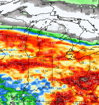
All told, between now and the end of next Tuesday, we can see an additional 1 to 3 inches of rain across a large part of Indiana and Ohio, and likely anywhere from 0.5 to 2 inches of rain in Michigan.
In Michigan, by far the best rain totals come in over the southern half of Lower Michigan, but we will not rule out good rains through all of the Lower Peninsula. The U.P. likely sees little to no additional moisture after Saturday midday to early afternoon.
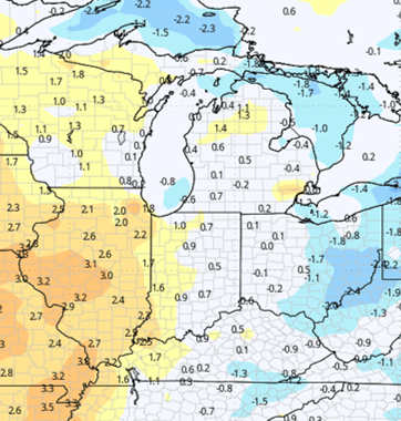
Temperatures through this time frame will be normal to slightly above normal. Humidity values, of course, will stay rather high due to all the moisture still working through.
The middle part of next week can shape up to be a little bit interesting. The low-pressure center that is triggering all of the moisture over the next four days looks to stall slightly as it moves east into Pennsylvania, New York and the southern parts of Quebec.
With that setup, backside moisture will wrap around into Michigan and Indiana. This yields predominantly cloud cover and a renegade shower or two, mostly in the east of the region, including the Michigan Thumb and eastern parts of Indiana.
In Ohio, this means solid rains continue for most of Wednesday and Thursday. Temperatures will cool a bit, but we’re not going to be falling off a cliff. Humidity values stay elevated at midweek.
The map at below shows rain potential from this weekend through Thursday, which includes any wraparound backside action that we just highlighted above.
We finally start to see drier air work into the entire region as we head toward the end of next week. High pressure will move in over Lake Superior and the Great Lakes in general.
This should give good sunshine through all of Michigan and all of Indiana through the weekend, holding right on through the first part of the next week. We are looking at low humidity values, and that should give great evaporation and faster drydown once we get into the later part of this upcoming weekend and through all of next week.

Extended Period:
The extended period features a strong front for Wednesday, the 30th. The low tracks across the Great Lakes, and the front sweeps through the entire region.
We can see 0.25 to 1 inch rain totals from this passage, but all moisture is done by the 1st. Dry weather returns to finish that week and for the weekend of the 3rd and 4th.
The first full week of October is a little bit more interesting, thanks to a solid disturbance working into the Missouri Valley that will try to throw some action into southern Indiana toward the 6th.
However, northern areas and all the Great Lakes will stay dry through the middle of the week of the 5th.
Weeks 3 & 4:
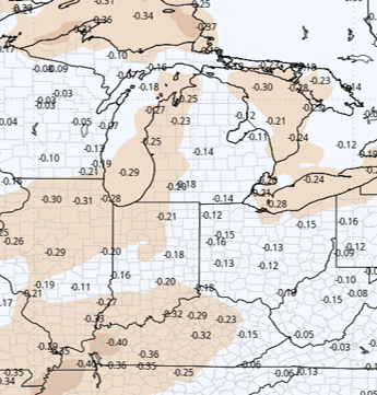
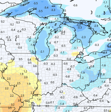
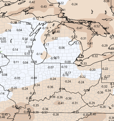
Week 3 precipitation is below normal, and Week 4 is near normal well into mid-October.
Temperatures will be normal to below normal for both weeks of our long-term forecast, but that is nothing that screams early frost or freeze.
Week 3 Precipitation:
Week 3 Temperature:
Week 4 Precipitation:
Week 4 Temperature: