
For the weekend, we look to stay cool with a continued damp setup for both days. Saturday, features clouds and limited sunshine. We’ll have to deal with another round of scattered showers trying to develop over northern parts of Indiana and southern Lower Michigan as we move through the Saturday afternoon, Saturday night and early Sunday time frame.
In Indiana, we’re talking mostly SR 26 and north. In Michigan, its mainly from the tip of the thumb back to about the Benton Harbor area and southeast of that line. Rain totals likely come in at half an inch or less, but its more about the fact that we have another day of no serious drying. Farther north in Michigan and farther to the south in Indiana, we likely just see clouds and some sunshine.
For Sunday, we do see another round of moisture trying to develop, this time farther south in the Ohio Valley, down into KY. Rains are not impressive at 30% coverage and under .25”. The rest of Michigan and Indiana should be precipitation free.
The main story of the weekend, outside of moisture, will be cold air diving in behind the front for Sunday afternoon. This will set the stage for frosty conditions all over MI, with some hard freeze the farther north you go. In Indiana we can wake up to frost Monday morning in the northern half of the state, but you get south of I-70, and we end up with temperatures that are cool but not cold enough to be concerned about widespread frost.

Next week starts off with a dry Monday. After that frosty start, we see temperatures climb. Our next system tries to move in overnight Tuesday night and Wednesday. Showers are likely regionwide. A few limited thunderstorms. Rain totals are going to end up anywhere from .25”-75” with coverage at around 80% of Indiana and 90% in MI. Lingering wrap around moisture works through on Wednesday. That means we see decent cloud cover, especially in Michigan but Indiana sees more clouds than sun as well. Thursday should continue a dry stretch with no more than a few fair weather clouds. And then the week finishes with a Friday, Saturday period that ends up with mixed clouds and sunshine. Moisture is building to our West across Iowa, Missouri, Illinois, but it does not look like it can break free into our region until closer to Sunday morning.
Sunday the 17th features showers and thunderstorms over central and southern parts of the eastern corn belt. We currently are looking at rain totals anywhere from .5”-1.5” on coverage of 90% for Indiana. The system kicks out by early Monday morning. However, that system largely misses MI, meaning we will be in a window that lacks precipitation and may give a good opportunity for field work.
Extended Period:
The week of the 18th features a dry start. High pressure in control. Monday through Wednesday. We see very warm temperatures and good drying through that stretch. Moving forward, we can see scattered showers trying to pop up for Thursday afternoon, but they’re very scattered. A lot of areas can get missed. Same story for Friday. I do think that as we finish out the week and go into the start of the Memorial Day weekend, everybody sees at least a little bit of precipitation in that area.
Weeks 3 & 4:
Near to slightly below normal temperatures for weeks 3 and 4, but precipitation pulls back to near normal. That means we should see increasing chances of some dry windows heading into early June.
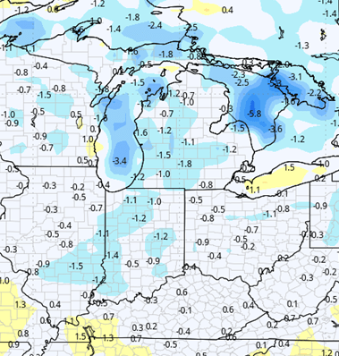
Week 3 Precipitation: 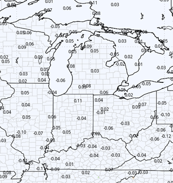
Week 3 Temperature: 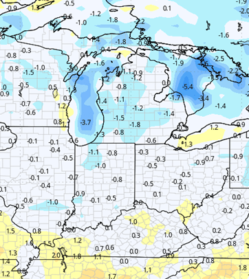
Week 4 Precipitation: 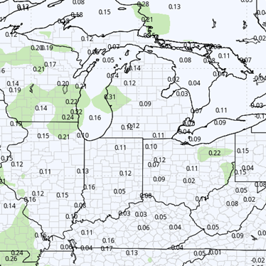
Week 4 Temperature: