
Much like Tyrese Haliburton hitting the game-winning shot for the Indiana Pacers last Thursday night in Game 1 of the NBA Finals against the Oklahoma City Thunder, it’s now late in the fourth quarter when it comes to Indiana’s farmers needing to finish their corn and soybean planting for the year.
Unfortunately, the weather may not be as cooperative for those needing to get the rest of their seed in the ground.
“Drying appears to be a little bit difficult over the next couple of weeks,” says Hoosier Ag Today’s Chief Meteorologist Ryan Martin. In fact, a significant amount of rain fell in southern Indiana on Friday causing flooding through parts of Salem and Washington County.
After the rainfall we saw throughout this past week and weekend, he says the biggest window for drying and evaporation is this coming week.
“I think we then are dry and getting sunshine back for later Tuesday afternoon through Wednesday, Thursday, Friday—and I’m going to say the first part of Saturday,” he says. “Evaporation rates will be at near maximum, and I think we start drying pretty good. We just got a lot of moisture to work through by that point in time.”
Ryan says there’s a lot of instability as we look ahead to this coming weekend.
“Heat and humidity are going to be part of this, but just overall moisture flow off the Gulf into the Eastern Corn Belt. So, I’m going to say hit-and-miss scattered showers and thunderstorms are possible each day, especially in the afternoons, and we can look at a combined rainfall amount of one-half to one inch across 90 percent of the Hoosier State.”
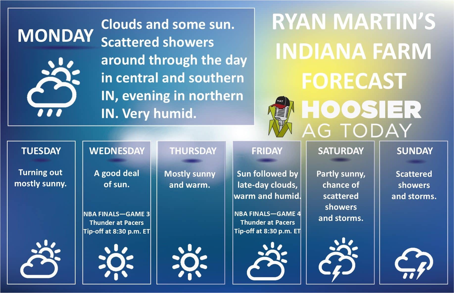
What does Ryan’s forecast look like for the week of Monday, June 16th—which is also the week of the Indiana FFA State Convention in West Lafayette?
“We’re dry next Tuesday through the end of the week. We’re talking about the 17th through at least the 19th and 20th—but we’re also seeing some significant warm air, some heat building in that time frame,” he says.
CLICK BELOW to hear Hoosier Ag Today’s radio news report: